 SmartBirds

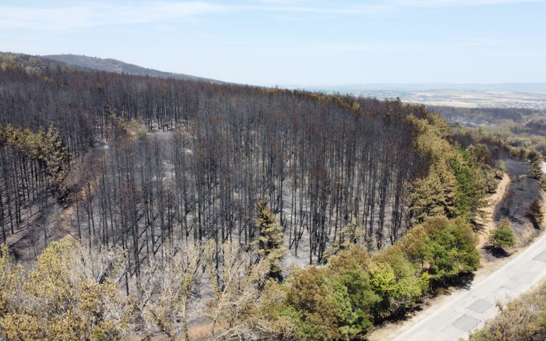
Picture: Anton Stamenov – BSPB
As part of the project “Iron Curtain to Green Belt”, developed in partnership with the Geopolymorphic Cloud Association, a dynamic model for assessing fire risk and the vulnerability of forest areas in South-Eastern Bulgaria was developed. The model is based on a set of indicators reflecting environmental conditions and their relationship to the occurrence and spread of forest fires.
The primary objective is to use spatial analyses, land cover data, and forest condition data to assess the recovery of forest vegetation following fires — with regard to species composition — and to prioritise activities for the transformation of conifer plantations into natural broadleaf forests.
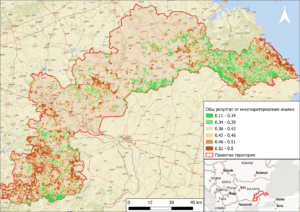
Fig. 1. Overall result – management areas for prioritization of subdivisions for reduction (or transformation) of fuel material in forest areas. Priority level: with green – very low (0.11 – 0.38)/low (0.38 – 0.42); with yellow – medium (0.42 – 0.46); with orange – high (0.46 – 0.51); with red – very high 0.51 – 0.8).
The analysis employs a multi-criteria model based on the work developed under the FIRE RES project, designed to prioritise forest sub-compartments with the aim of reducing the risk of large-scale fires. The model combines various indicators (of differing scales and significance) into an overall risk score, using a multi-criteria decision analysis (MCA/MCDA) approach.
The modelling incorporates two main groups of indicators: 1) Fire Hazard (fuel characteristics, fire behaviour, historical fires, susceptibility); and 2) Exposure and Vulnerability (human health, economic activities, cultural heritage, and the environment). Weights reflecting the significance of each group and subgroup have been assigned for the assessment of risk across individual forest sub-compartments.
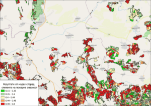
Fig. 2. Model for the Elhovo State Forestry Enterprise, according to a group of Fire Danger indicators. Priority level: with green – very low (0.11 – 0.38)/low (0.38 – 0.42); with yellow – medium (0.42 – 0.46); with orange – high (0.46 – 0.51); with red – very high 0.51 – 0.8).
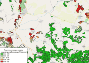
Fig. 3. Model for the Elhovo State Forestry Enterprise, according to a group of indicators for Exposure and Vulnerability. Priority level: with green – very low (0.11 – 0.38)/low (0.38 – 0.42); with yellow – medium (0.42 – 0.46); with orange – high (0.46 – 0.51); with red – very high 0.51 – 0.8).
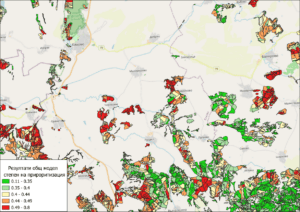
Fig. 4. General model for the Elhovo State Forestry Enterprise area, according to the two groups of indicators. Priority level: with green – very low (0.11 – 0.38)/low (0.38 – 0.42); with yellow – medium (0.42 – 0.46); with orange – high (0.46 – 0.51); with red – very high 0.51 – 0.8).
The selection of indicators was informed by an analysis of six significant fire events (over 500 ha each) that occurred after 2012. Data were sourced from the Executive Forest Agency (EFA) system and supplemented with satellite imagery from platforms including Copernicus and EarthExplorer. Analysis of these events made it possible to identify key factors influencing fire spread rate and intensity, such as fuel type and moisture content, wind speed, and temperature.
The outcome is a geo-referenced layer of fuel models for the project area, incorporating indicator weights and the spatial distribution of fire risk. Fire behaviour modelling was carried out using FlamMap software, with input data drawn from both field observations (collected via the Fire-Res application) and satellite imagery.
The results will be made available in a user-friendly format for relevant stakeholders, and allow for:
- identification of areas with the highest risk of fire occurrence and spread;
- assessment of the influence of different vegetation types (conifer and broadleaf forests) on fire behaviour;
- identification of key manageable factors related to the fuel model;
- Evaluation of the effect of conifer plantation transformation on reducing fire risk.
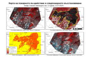
Fig. 5. Analysis of past fires. Map of fire impact and post-fire vegetation recovery of a fire that started in the village of Studena, 13.07.2024. In order to visually present the impact of the fire on the territory and vegetation, all stages of the event are presented – before and after the fire, as well as an image at least 2 years after the fire, showing the recovery of vegetation.
Based on this analysis, guidance can be formulated for priority activities, including prioritisation of areas for replacement of conifer stands with broadleaf species, understorey management, and fuel material optimisation. These measures have the potential to reduce fire risk and support the recovery of more resilient forest ecosystems.
On 10 June, a meeting was held in Plovdiv at which the results were presented, with the aim of engaging stakeholders in a discussion to identify and prioritise activities related to the restoration of natural forest ecosystems and fire risk management. The meeting was attended by representatives of the Ministry of Environment and Water, the Ministry of Agriculture and Food, the Executive Forest Agency, State Forestry Enterprises from the project area, environmental institutions, fire services, non-governmental organisations, and academic institutions.


